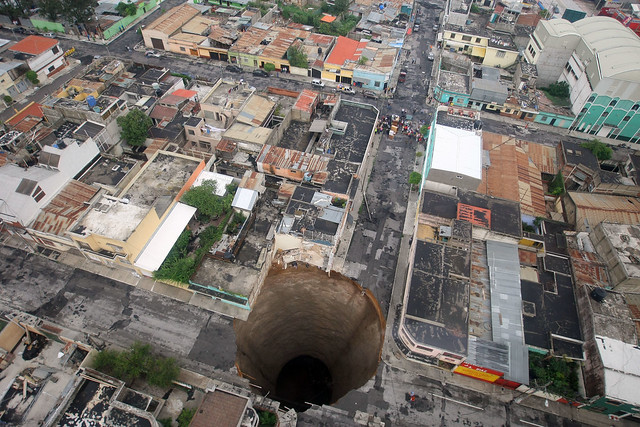
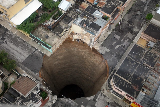
Torrential rains brought on by tropical storm Agatha pounded Guatemala City in 2010, resulting in a massive sinkhole 100 feet deep and 66 feet wide. The flooding caused the ground to collapse, swallowing up a three-story factory and a city intersection.


Sinkholes are commonly found in areas where the bedrock is limestone, or some other rock that can be dissolved by ground water, according to the US Geological Survey. As the rock dissolves, huge cavities are formed. And when there is nothing left to support the land surface, it collapses, forming the sinkhole.
In this case, the recent rains as well as underground sewage flow from a ruptured main were believed to have encouraged the giant hole.

Like this:
Like
2 bloggers like this.
This is really fascinating! The pictures are unbelievable and I especially love the diagram helping to explain how a sinkhole is formed.
Thanks Kelly! My stomach does a dip when I look at these pictures